


ZANESVILLE Voting District, Montgomery County, Illinois
About
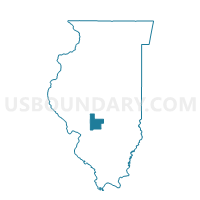
Outline

Summary
| Unique Area Identifier | 573638 |
| Name | ZANESVILLE Voting District |
| County | Montgomery County |
| State | Illinois |
| Area (square miles) | 36.86 |
| Land Area (square miles) | 36.66 |
| Water Area (square miles) | 0.20 |
| % of Land Area | 99.45 |
| % of Water Area | 0.55 |
| Latitude of the Internal Point | 39.29860170 |
| Longtitude of the Internal Point | -89.64746390 |
Maps


Graphs
Select a template below for downloading or customizing gragh for ZANESVILLE Voting District, Montgomery County, Illinois


Neighbors
Neighoring Voting District (by Name) Neighboring Voting District on the Map
- BUTLER GROVE Voting District, Montgomery County, IL
- HARVEL Voting District, Montgomery County, IL
- HONEY POINT Voting District, Macoupin County, IL
- NILWOOD 2 Voting District, Macoupin County, IL
- NORTH LITCHFIELD 1 Voting District, Montgomery County, IL
- NORTH LITCHFIELD 4 Voting District, Montgomery County, IL
- PITMAN Voting District, Montgomery County, IL
- RAYMOND Voting District, Montgomery County, IL
- SHAWS POINT Voting District, Macoupin County, IL
Top 10 Neighboring County Subdivision (by Population) Neighboring County Subdivision on the Map
- North Litchfield township, Montgomery County, IL (5,148)
- Raymond township, Montgomery County, IL (1,200)
- Butler Grove township, Montgomery County, IL (775)
- Nilwood township, Macoupin County, IL (637)
- Shaws Point township, Macoupin County, IL (532)
- Pitman township, Montgomery County, IL (508)
- Zanesville township, Montgomery County, IL (491)
- Harvel township, Montgomery County, IL (243)
- Honey Point township, Macoupin County, IL (155)
Top 10 Neighboring Place (by Population) Neighboring Place on the Map
Top 10 Neighboring Unified School District (by Population) Neighboring Unified School District on the Map
- Carlinville Community Unit School District 1, IL (9,460)
- Litchfield Community Unit School District 12, IL (8,992)
- Panhandle Community Unit School District 2, IL (3,358)
Top 10 Neighboring State Legislative District Lower Chamber (by Population) Neighboring State Legislative District Lower Chamber on the Map
Top 10 Neighboring State Legislative District Upper Chamber (by Population) Neighboring State Legislative District Upper Chamber on the Map
Top 10 Neighboring 111th Congressional District (by Population) Neighboring 111th Congressional District on the Map
Top 10 Neighboring Census Tract (by Population) Neighboring Census Tract on the Map
- Census Tract 9576, Montgomery County, IL (3,481)
- Census Tract 9575, Montgomery County, IL (3,273)
- Census Tract 9563, Macoupin County, IL (3,266)